Eine skalierbare Plattform zur Beobachtung und Vorhersage von Biodiversität auf Basis neuartiger Gemeinschaftssensoren und künstlicher Intelligenz
„You only treasure what you measure.“
Der Verlust biologischer Vielfalt ist eine der großen Herausforderungen unserer Zeit. Was global diskutiert wird, betrifft Bayern ganz konkret: Arten verschwinden, Lebensräume verändern sich, klimatische Extreme nehmen zu. Doch obwohl Biodiversität politisch hohe Priorität genießt, fehlt uns oft ein präzises, flächendeckendes Bild ihres aktuellen Zustands und ihrer Dynamik.
Genau hier setzt BaySenseAI an. Das Projekt verbindet modernste Technologien aus Erdbeobachtung, Biodiversitätsforschung und künstlicher Intelligenz zu einer gemeinsamen Vision: einer skalierbaren, KI-basierten Plattform, die Biodiversität nicht nur dokumentiert, sondern auch Prognosen zu Ihrer Veränderung abgeben kann.
Im Zentrum stehen sogenannte Foundation-Modelle – leistungsfähige KI-Modelle, die multimodale Datenquellen integrieren können. Satellitenbilder, Klimazeitreihen, Geländeaufnahmen und Biodiversitätserhebungen werden gemeinsam analysiert, um lokale Artenzusammensetzungen präzise zu prognostizieren.
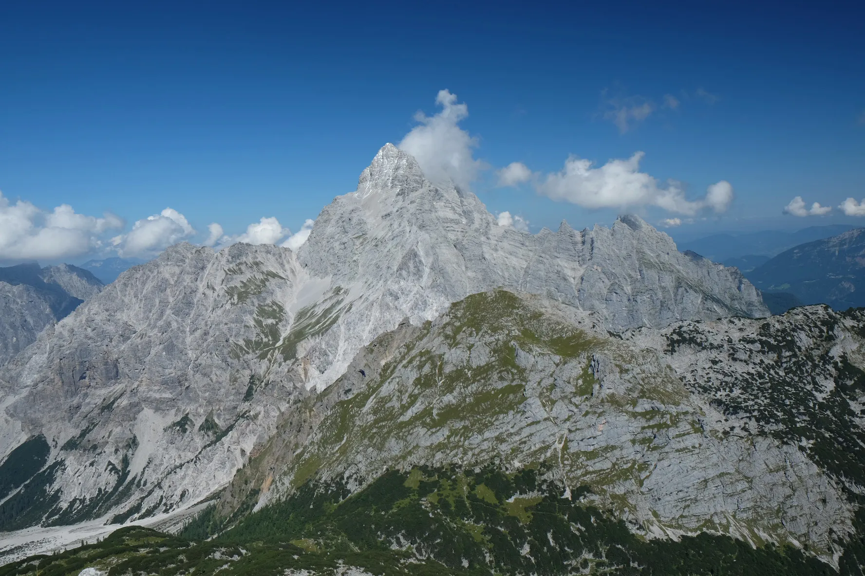
Entwickelt und erprobt wird die Plattform im Nationalpark Berchtesgaden – einer Region mit außergewöhnlicher ökologischer Vielfalt. Langfristig ist die Anwendung für ganz Bayern geplant. BaySenseAI schließt damit eine zentrale Monitoring-Lücke und legt die Grundlage für datenbasierte, zukunftsfähige Naturschutzstrategien.
Der weltweite Biodiversitätsverlust ist längst auch in Bayern spürbar. Arten reagieren sensibel auf Klimawandel, Landnutzungsänderungen und menschliche Eingriffe. Für wirksame Schutzmaßnahmen braucht es jedoch verlässliche Informationen: Wo verändern sich Artengemeinschaften? Welche Lebensräume sind besonders betroffen? Und wie entwickeln sich seltene oder schwer nachweisbare Arten?
Bisher beruhen viele Antworten auf aufwendiger Feldarbeit – präzise, aber zeit- und kostenintensiv. Gleichzeitig stehen heute Technologien zur Verfügung, die noch vor wenigen Jahren undenkbar waren.
Hintergrund
Der weltweite Biodiversitätsverlust ist längst auch in Bayern spürbar. Arten reagieren sensibel auf Klimawandel, Landnutzungsänderungen und menschliche Eingriffe. Für wirksame Schutzmaßnahmen braucht es jedoch verlässliche Informationen: Wo verändern sich Artengemeinschaften? Welche Lebensräume sind besonders betroffen? Und wie entwickeln sich seltene oder schwer nachweisbare Arten?
Bisher beruhen viele Antworten auf aufwendiger Feldarbeit – präzise, aber zeit- und kostenintensiv. Gleichzeitig stehen heute Technologien zur Verfügung, die noch vor wenigen Jahren undenkbar waren.
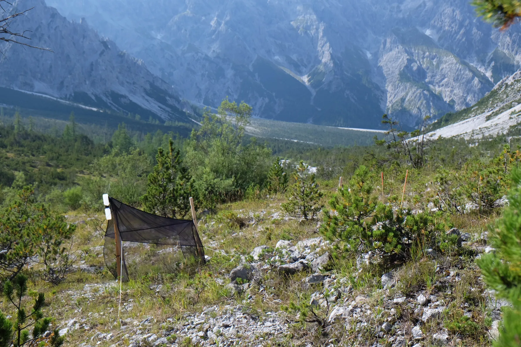
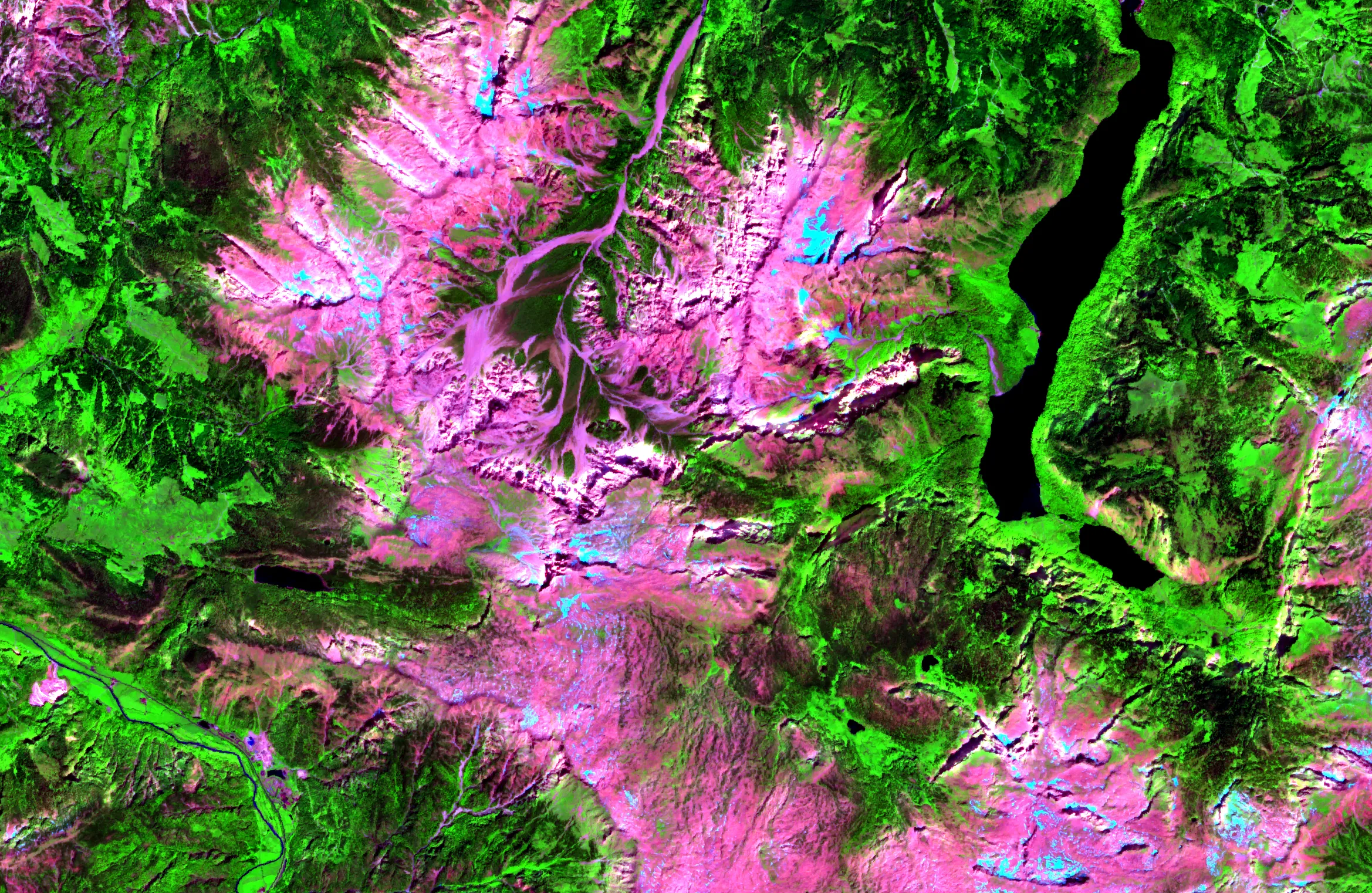
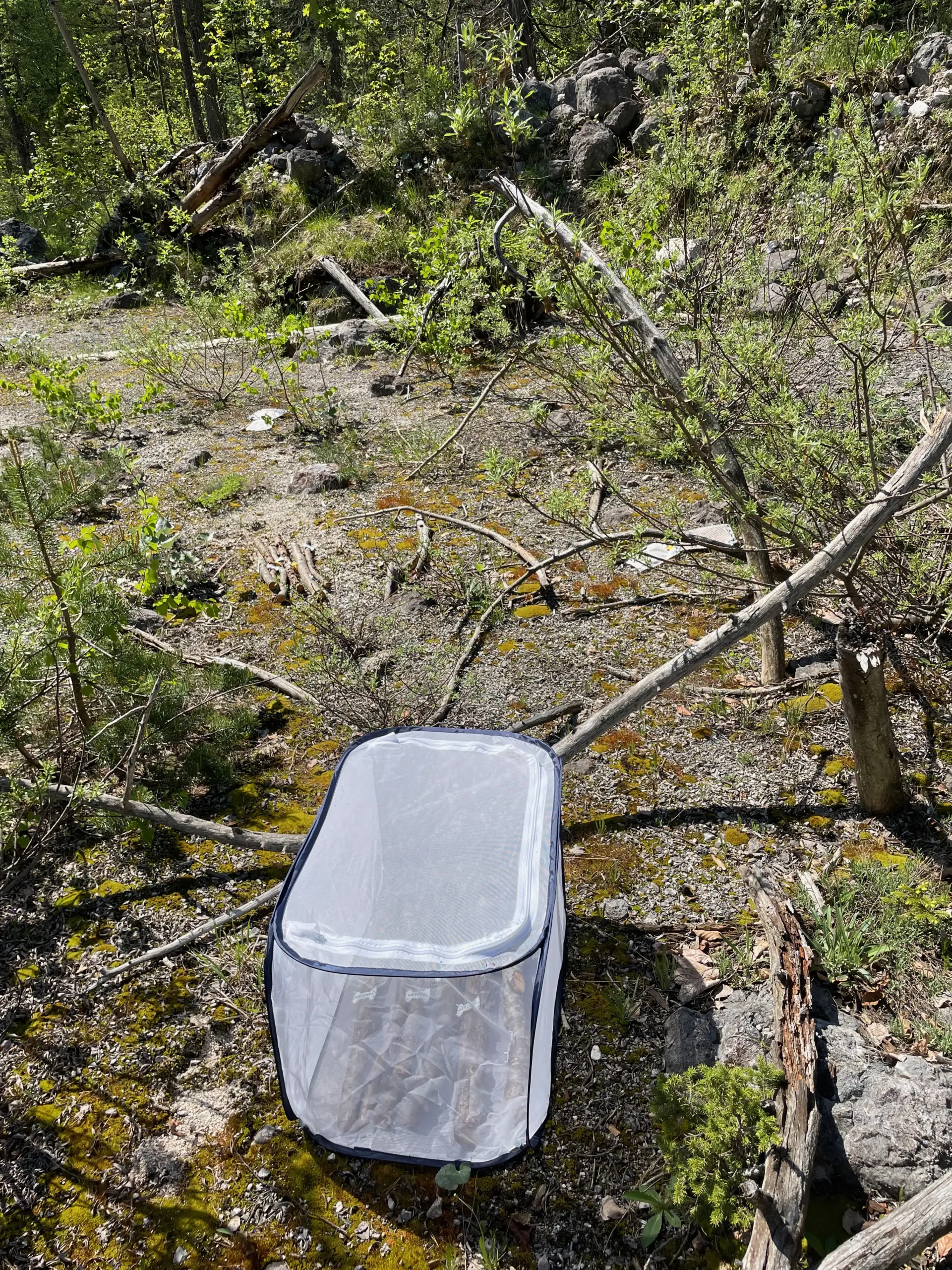
BaySenseAI nutzt diese technologische Zeitenwende. Modernste Methoden des Biodiversitätsmonitorings – etwa Audiorekorder zur Erfassung von Vogel- und Insektenstimmen, Kamerafallen für Säugetiere oder DNA-Metabarcoding zur Analyse der Vielfalt auf genetischer Ebene – werden mit Erdbeobachtungsdaten kombiniert. Satelliten liefern kontinuierliche Informationen zu Vegetationszustand, Temperatur oder Feuchtigkeit, ergänzt durch LiDAR- und hyperspektrale Befliegungen, die die Struktur von Lebensräumen dreidimensional erfassen.
Diese Datenvielfalt wird mithilfe künstlicher Intelligenz zusammengeführt. Foundation-Modelle können Bilder, Zeitreihen und Textinformationen gleichzeitig verarbeiten – und daraus ökologische Muster ableiten. So entsteht erstmals die Möglichkeit, Biodiversitätsveränderungen großräumig, systematisch und skalierbar abzubilden.
Methoden und Ziele
Die Entwicklung der Plattform beginnt in einer Modellregion mit besonderer Aussagekraft: dem Nationalpark Berchtesgaden. Zwischen alpinen Gipfeln, Wäldern und Tallandschaften erstreckt sich hier ein ausgeprägter ökologischer Gradient – ein natürlicher „Stresstest“ für das Modell. Frei nach dem Motto: Funktioniert es in Berchtesgaden, funktioniert es auch anderswo.
Die Umsetzung erfolgt in drei eng verzahnten Schritten:
- Erhebung hochauflösender Biodiversitätsdaten: Auf über 200 Probeflächen werden mithilfe modernster In-situ-Sensoren Arten und Artengemeinschaften erfasst.
- Integration vielfältiger Erdbeobachtungsdaten: Satelliten- und flugzeuggestützte Systeme liefern ergänzende Umweltinformationen, die räumlich und zeitlich aufbereitet werden.
- Verknüpfung durch KI-gestützte Foundation-Modelle: Beide Datenströme werden in einem gemeinsamen Modell integriert.
Ein besonderer Mehrwert liegt in der Fähigkeit der Foundation-Modelle, ökologische Zusammenhänge eigenständig zu erkennen. Arten werden nicht isoliert betrachtet, sondern als Teil einer Gemeinschaft. Erkennt das Modell eine Art mit hoher Sicherheit, kann es daraus ableiten, dass bestimmte Begleitarten wahrscheinlich ebenfalls vorkommen. Das Modell arbeitet somit auf Ebene ganzer Artengemeinschaften – ein Paradigmenwechsel gegenüber klassischen, einzelartbasierten Ansätzen.
Langfristiges Ziel ist die Skalierung auf ganz Bayern. So sollen flächendeckende, lokal differenzierte Biodiversitätsvorhersagen sowie belastbare Aussagen zu Veränderungen in allen bayerischen Ökosystemen möglich werden.
Der Mehrwert für den Freistaat Bayern ist unmittelbar
BaySenseAI schafft eine innovative Plattform für das Biodiversitätsmonitoring im Freistaat. Die daraus gewonnenen Vorhersagen eröffnen vielfältige Anwendungsmöglichkeiten:
- Unterstützung bei der Ausweisung und Priorisierung von Schutzgebieten
- Grundlage für regionale Planungsprozesse
- Frühzeitige Identifikation sensibler oder gefährdeter Lebensräume
- Bewertung klimabedingter Veränderungen
Darüber hinaus verbindet das Projekt praxisnahe Forschung im Nationalpark Berchtesgaden mit universitärer Spitzenforschung. Bayern positioniert sich damit als Vorreiter für KI-gestützte Biodiversitätsanalysen in Europa.
Mögliche Synergien innerhalb von bayklif2
BaySenseAI arbeitet eng mit dem Nationalpark Berchtesgaden zusammen. Die dort erhobenen Daten stehen weiteren Forschungsprojekten zeitnah zur Verfügung und stärken so das wissenschaftliche Netzwerk in Bayern.
Die im Projekt entwickelten Methoden sind modular aufgebaut und langfristig erweiterbar. Sie können auf andere Regionen, zusätzliche Artengruppen oder neue Sensortechnologien übertragen werden.
So entsteht nicht nur eine Plattform für heutige Fragestellungen, sondern ein Fundament für die Biodiversitätsforschung von morgen.
BaySenseAI erzählt damit eine Geschichte von technologischer Innovation, interdisziplinärer Zusammenarbeit und dem gemeinsamen Ziel, Bayerns biologische Vielfalt sichtbar, messbar und damit schützbar zu machen.
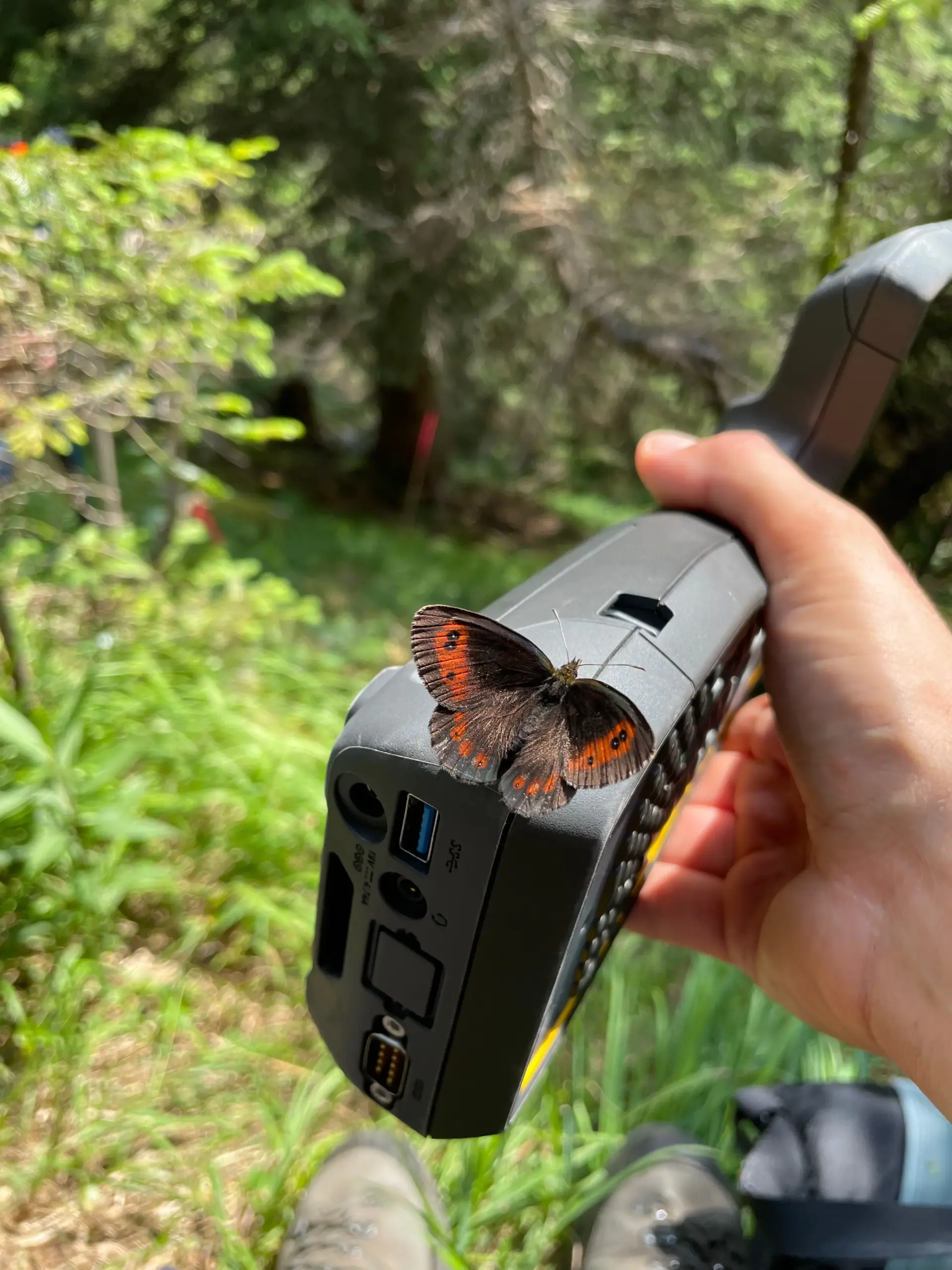
im Nationalpark Berchtesgaden /
Fotos: Cornelius Senf
Team
Projektleitung

Prof. Dr. Florian Hartig
Universität Regensburg
Theoretical Ecology and Ecological Data Science
Florian.Hartig@ur.de
Projektleitung
Prof. Dr. Rupert Seidl
Technische Universität München
Ökosystemdynamik und Waldmanagement in Gebirgslandschaften
rupert.seidl@tum.de

Prof. Dr. Cornelius Senf
Technische Universität München
Earth Observation for Ecosystem Management
cornelius.senf@tum.de